HOULSTON
Houlston & Sons Maps
Edward Houlston, son of a Shropshire printer, set up in London in 1826. In the 1860s the business was known as Houlston & Wright, based at 65 Paternoster Row. It mainly produced works on religious, temperance and self-improvement themes (‘Bob the Crossing Sweeper’, ‘Every Man his own Farrier’). In 1870 the firm became Houlston & Sons, moving in 1872 to 7 Paternoster Buildings, Paternoster Square.
An 1880 advert stated the maps to be ‘Under constant revision… Recommended by Members of the leading Bicycle Clubs’. An advert of 1883 in the Publishers’ Gazette proclaimed
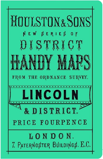
Houlston’s District Handy Maps… Reduced from the Ordnance Survey to a scale of Four Miles to an Inch… Each map comprises a District of about 2,000 Square Miles, and shows the latest alterations and Additions to Roads and Railroads, which are clearly marked. The sale of these accurate, clear, and cheap Pocket Maps is increasing daily, and Booksellers in Town and Country will find it to their advantage to keep a supply in Stock, as they are largely used by Cyclists and Tourists
Whereas the ‘Handy’ maps were taken from the 1866 Bartholomew base, at some stage these were in part superseded by ‘Dispatch’ or Cary maps (see under G. W. Bacon), which were actually of earlier origin. It is possible that a 1889 reference in the Publishers’ Circular to a new series of Houlston’s ‘District Handy maps' marked this change of origin from Bartholomew to Bacon-sourced, but the term ‘new’ was used so loosely in connection with maps of the period as to be largely meaningless. The introduction seems to have been made by 1900, as a review of the maps in the CTC Gazette for June that year noted ‘They are not based on the latest Ordnance Survey and are therefore liable to mislead’. Strangely, despite the change of map base, the original index numbering, titles and scale were retained for the remainder of the series’ lifetime and the Bartholomew Printing Record show they were still supplying some of the maps until the 1920s.
Back in 1881 the firm had published the Cyclists’ Pocket Road Guides by R. E. Phillips. These were a series of cards, 160 in all, covering the main roads and principal cross-roads of England, Scotland and Wales. Each card covered about 50 or 60 miles of road, giving intermediate distances and distances to adjacent places reached from the road. As such they were descendants of the old coaching road books, but in much more portable form. The complete set, in case, cost a guinea (21s), or the cards were available individually at 2d each. There was a separate key index (published at sixpence) to the whole, giving full particulars of the contour of the roads, and which was a useful map on its own.
Also advertised by Houlston in 1889 were Handy Maps of London (2 inches to the mile) and Isle of Wight (half-inch to mile).
In 1906 the company became part of Madgwick, Houlston & Co. Ltd, at 4 Ave Mara Lane, which perpetuated the maps, though the firm itself went into liquidation in 1913. The Houlston District Handy Maps and the two other sheets mentioned above were taken over and marketed by E. J. Larby Ltd, later branded as The Halford Cycle Co.'s District Handy Maps.
Despite being in production for half a century, and of a popular price and size, the Handy Maps do not appear to have sold in great numbers, judging by their rarity today compared to contemporary products. Their very cheapness and somewhat flimsy covers would also have made them more of a ‘throwaway’ item.